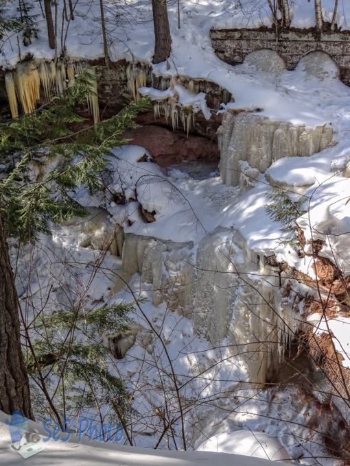
The highway department has been busy thawing out frozen culverts where the melting snow is causing water to run over the road. But those culverts don’t look as interesting or as pretty as these near Houghton Falls, where when this ice melts, it will flow into Lake Superior.
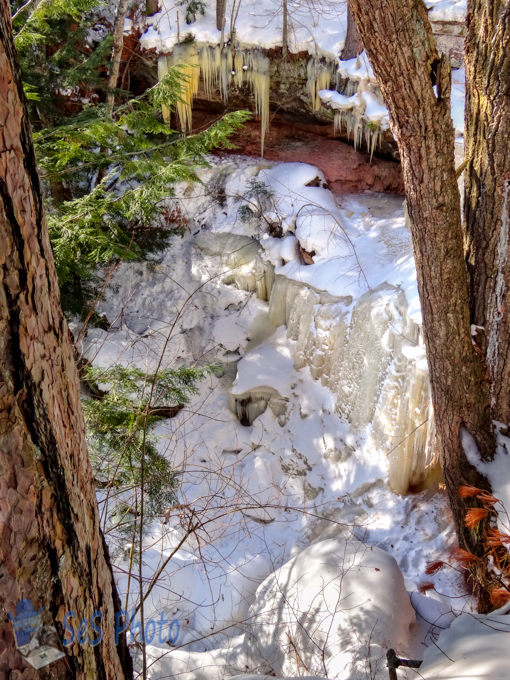
With the sun out for part of day and temperatures in the 30s, it was a nice winter day to take a hike through the woods if you had snowshoes, otherwise your foot would sink in or slide off the path with the wet snow.
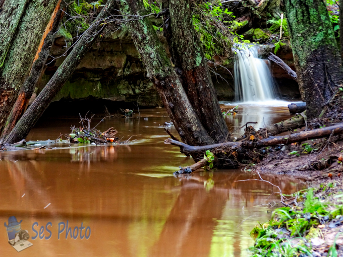
The supposedly sunny week didn’t last very long since rain is falling but hopefully the amounts will be light so no more flooding. The Houghton Falls was flowing with more water than normal after a heavy rain fall.
Even with another night in the minus teens, the weathermen are finally predicting some warmer temperatures and tomorrow the freezing mark will feel warm. And maybe some of the small little streams, like in Houghton Falls State Natural Area, will start flowing again as winter gives up its winter grip.
Old Man Winter must be confused with all the cloudy weather we have been having since now that it is officially winter, it is raining and melting the snow away. But it sounds like the snow will return soon enough, but in the mean time, I will dream of a warmer fall day on the banks of the stream in Houghton Falls State Nature Area.
Water can exist in three phases (solid, liquid and gas) and found in different locations (in the air, on the surface or below the ground). Well I’m not overly happy watching water falling in the form of snow blowing pass my window this morning. I much rather see the water falling in the form of a river and waterfall instead!
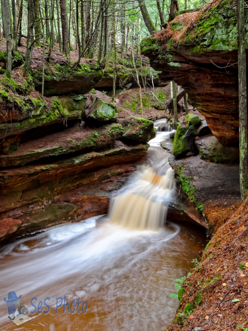
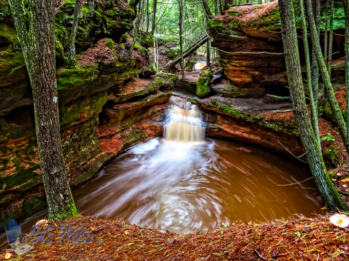
The Echo Dells in the Houghton Falls State Natural Area is a very interesting area and would be fun to explore more when the water isn’t flowing so rapidly.
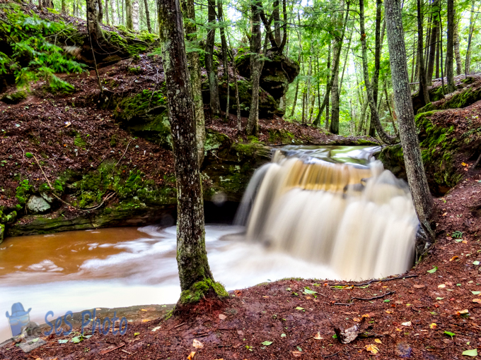
Upstream from Wednesday’s picture in the Houghton Falls State Natural Area is an area called Echo Dells (also known as Lover’s Glen). It is a picturesque pre-Cambrian sandstone gorge along the Lake Superior shore comprised of a series of water carved rock cliffs and caves with small waterfalls as the half mile stream meanders towards Lake Superior and drops sixty feet to a sandy cove at Houghton Point. A second falls can be seen in the background as the stream makes a curve around a harder piece of sandstone.
The dramatic formation has been a popular recreation and picnic spot since the late 1800’s and normally the water level is very low in the fall which allows the stream bed and the caves to be explored. But my first visit to this area was in the winter and I wasn’t about to climb down the ice and snow cover cliffs and chance breaking though the ice on the backed up water. And my recent visit was just after a big storm so the dry creek bed was filled with water and since it was still raining, the slippery rocks prevented access again. Maybe one day I will get to explore the rock formations and caves on a drier day.
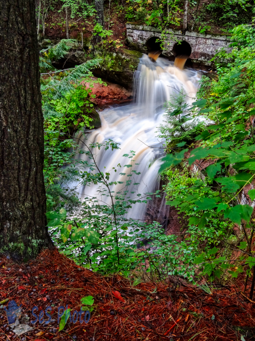
The arrival of the railroad in 1883 to Washburn (south of Bayfield, WI) stimulated quarrying and logging activities. There was three quarries located in the area known as Houghton Point and the railway carried the brownstone building material to Chicago, Minneapolis, St. Paul and Cincinnati.
The Houghton Point quarry opened in 1892 but the brownstone industry quickly ended by 1903 as the stone was replaced by concrete and other building materials. And eventually, the rail service was discontinued and abandoned. The old railway cuts through the Houghton Falls State Natural Area and the old railway culverts over the creek still exists, although I wouldn’t want to have derailed by the deep ravine as the creek drops sixty feet as it makes it way into Lake Superior.