Tag: Lake Superior

Picture of the Day for December 22, 2015

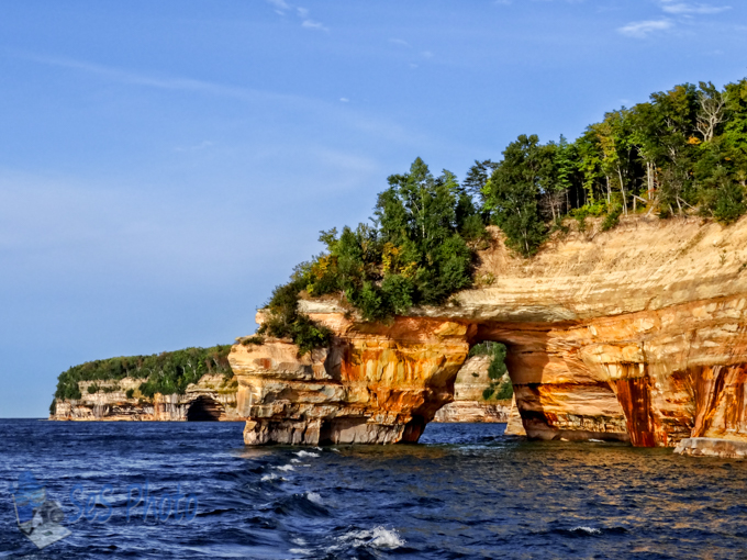
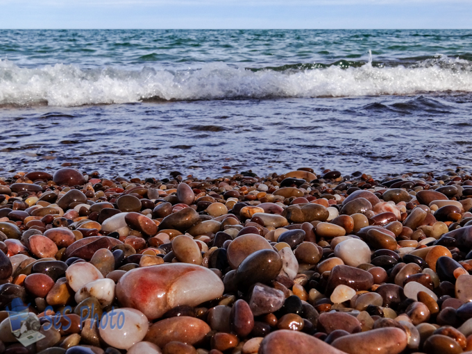
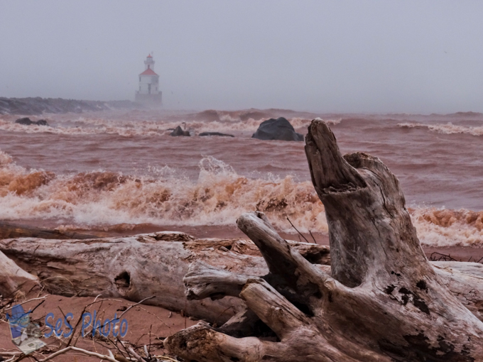
Winter wanted its presence known as there was a coating of snow overnight and the pond is ice covered again. It takes lots of cold nights before the ice starts forming on Lake Superior so one would see open water by Lovers Leap although a bit chilly for leaping and swimming. (And you wouldn’t want to leap there since the water is only a few feet deep even if the lore has lovers leaping together to profess their love.) In the background behind the arch of Lovers Leap is Rainbow Cave.

Lovers Leap

Lovers Leap

Picture of the Day for December 9, 2015

With the numerous muddy paw prints from the cats who want holding covering the front of my jacket and coated with sawdust all over it, my coat could use a washing. And if I threw it in one of the “Caves of All Colors”, it just swirl around like a big washing machine – at least on a calm day. There probably wouldn’t be anything left of my old jacket if it was in there on a stormy days as the waves pounded into the wall. Caves of All Colors are part of the Pictured Rocks National Lakeshore, a U.S. National Lakeshore on the shore of Lake Superior in the Upper Peninsula of Michigan, which extends for 42 miles along the shore.

Caves of All Colors

Caves of All Colors

Picture of the Day for December 7, 2015

A “date that will live in infamy” is how President Franklin D. Roosevelt described Japanese attacks on the U.S. fleet at Pearl Harbor in a speech to the joint session of Congress on the day after the attack on December 7, 1941. Of the more than 2,400 Americans killed in the attack, almost half of those who died were aboard the USS Arizona. This February, the last surviving officer of the USS Arizona, died at the age of 100 and there are now only eight crewmen from the Arizona still living.

Since I haven’t been to Hawaii to visit the USS Arizona Memorial, I have no pictures of it but this old fishing boat might not seen damage from war, but has been worn down from years of hard work and the icy waters of Lake Superior.

Boat Battling Age

Boat Battling Age

Picture of the Day for October 13, 2015

Few waterfalls actually fall directly into Lake Superior but instead drop in elevation just before reaching its destination. But there are some which do, like Spray Falls in the Pictured Rocks National Lakeshore, which drops 70 feet directly into Lake Superior. You can’t hike around behind the falls since the cliff hasn’t been cut back into the rock and the lake it too chilly for swimming but the best views of the falls are from the lake.

Spray Falls

Spray Falls

Picture of the Day for October 6, 2015

Landscapes can change in a very short distance and it is interesting how one beach may be all sand and around the bend it is solid rocks or small rocks. And if there are small rocks on the beach, there has to be at least one “pretty” rock that hops into your pocket although sometime that pretty one may be elusive when a wave takes it out of your reach.

A Pretty Rock

A Pretty Rock

Picture of the Day for October 1, 2015

Cliffs rising 50 to 200 feet above Lake Superior for 15 miles south side are decorated or ‘painted’ with colorful streaks and are part of the Pictured Rock National Lakeshore. The 500 million-year-old sandstone are stained from mineral filled groundwater leaching out of the rock. Minerals like iron, copper, manganese, and limonite create the red, orange, yellow, blue, green, brown, black, and white colors.

Pictured Rocks

Pictured Rocks


Picture of the Day for June 17, 2015

A river flows onward to another river, lake, sea or ocean, unless it dries up before reaching its destination and they can be many miles or just a few. The Montreal River is a river flowing to Lake Superior in northern Wisconsin and the Upper Peninsula of Michigan. Much of the river’s course defines a portion of the Wisconsin–Michigan border. The Ojibwe name for the river is Gaa-waasijiwaang, meaning “where there is whitewater”.  And there is some ‘whitewater’ on this river as it drops more than a thousand feet in less than 50 miles as it travels downstream over four named waterfalls (Peterson Falls, Interstate Falls, Saxon Falls and Superior Falls) before empties calmly into Oronto Bay on Lake Superior.

The Montreal River looks rather peaceful at its mouth even though it just went over a 90 foot drop a short walk in the opposite direction.

Montreal River Reaching Lake Superior

Montreal River Reaching Lake Superior

Picture of the Day for May 28, 2015

While out on a day trip today, one stop was the Wisconsin Point, a peninsula off the shore of Superior, Wisconsin. The point is the world’s largest freshwater bay mouth sand bar. The Wisconsin Point Lighthouse was built in 1913 and is located on the end of the peninsula.

But today the lighthouse wasn’t very visible nor could you see Lake Superior because of the fog rolling in on a chilly afternoon when the temperature was 45 with a colder wind chill. And while I was hoping for a nice sunny day to walk out to the lighthouse, the need for lighthouses and fog horns wouldn’t have existed if the weather was always calm and sunny.

Lighthouse Lost in the Fog

Lighthouse Lost in the Fog


A short video of the lighthouse lost in the fog as the waves roll in on a windy day.