Tag: Waterfall

Picture of the Day for November 19, 2014

Watching more snow falling outside has me wishing for warmer days and watching something else fall, like water falling over a cliff. Even during a dry fall, the Upper Falls on the Baptism River is quite impressive and you can see the rock bed behind the water which is impossible in the springtime when a thick wall of water rushes over the edge covering the full river bed channel. Sure would be nice to sit on a rock on a sunny day listening to the falling water dropping sixty feet, enjoying the scenery and watching the white foam forming at the base of the waterfall rather than seeing white snow blowing by.

Falling Water

Falling Water

Picture of the Day for November 6, 2014

The view at the upper falls on the Amnicon River has changed from two months ago.  In September when this picture was taken, the trees were all green yet while last month the turning leaves would have added a array of colors on the scene. This month the trees would be bare except the evergreens and soon the ground will be white and ice forming on the water. Maybe next year I can head up north to see the falls in the autumn glorious colors.

Amnicon Upper Falls

Amnicon Upper Falls

Picture of the Day for October 10, 2014

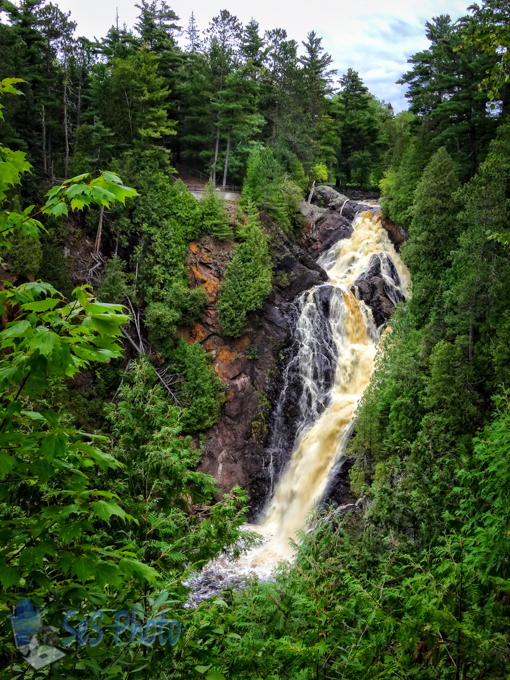
A picture just doesn’t do justice to the 165 foot Big Manitou Falls waterfall, the tallest waterfall in Wisconsin and the fourth tallest east of the Rockies. It is only two feet shorter than Niagara Falls, but it is a lot ‘skinnier’ although it still rumbles as the water plunges to the bottom.

Both the Big Manitou Falls and Little Manitou Falls are on the Black River located in Pattison State Park. In the tumbling waters of Big Manitou Falls, the Ojibwa believed they heard the voice of the Great Spirit within the roaring of the falls and gave it the name “Gitchee Manitou”.

If it wasn’t for a lumberjack and miner from Michigan, I might have never had the chance to see this waterfall since there was plans to build a hydroelectric dam on the river which would’ve destroyed the waterfall. Martin Pattison blocked the development by secretly purchased 660 acres along the river from a number of landowners and became a state park in 1920.
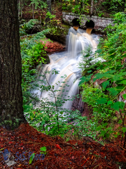
Big Manitou Falls

Big Manitou Falls

Picture of the Day for September 26, 2014

Upstream from Wednesday’s picture in the Houghton Falls State Natural Area is an area called Echo Dells (also known as Lover’s Glen).  It is a picturesque pre-Cambrian sandstone gorge along the Lake Superior shore comprised of a series of water carved rock cliffs and caves with small waterfalls as the half mile stream meanders towards Lake Superior and drops sixty feet to a sandy cove at Houghton Point. A second falls can be seen  in the background as the stream makes a curve around a harder piece of sandstone.

The dramatic formation has been a popular recreation and picnic spot since the late 1800’s and normally the water level is very low in the fall which allows the stream bed and the caves to be explored. But my first visit to this area was in the winter and I wasn’t about to climb down the ice and snow cover cliffs and chance breaking though the ice on the backed up water. And my recent visit was just after a big storm so the dry creek bed was filled with water and since it was still raining, the slippery rocks prevented access again. Maybe one day I will get to explore the rock formations and caves on a drier day.

Echo Dells

Echo Dells

Picture of the Day for September 24, 2014

The arrival of the railroad in 1883 to Washburn (south of Bayfield, WI) stimulated quarrying and logging activities. There was three quarries located in the area known as Houghton Point and the railway carried the brownstone building material to Chicago, Minneapolis, St. Paul and Cincinnati.

The Houghton Point quarry opened in 1892 but the brownstone industry quickly ended by 1903 as the stone was replaced by concrete and other building materials. And eventually, the rail service was discontinued and abandoned. The old railway cuts through the Houghton Falls State Natural Area and the old railway culverts over the creek still exists, although I wouldn’t want to have derailed by the deep ravine as the creek drops sixty feet as it makes it way into Lake Superior.

Old Railway Over Plunging Creek

Old Railway Over Plunging Creek

Picture of the Day for September 21, 2014

I was going to post an old church picture, which I often do on a Sunday, but the picture I took of an old abandon church during the storm on Lake Superior had a rain drop on the lens which I didn’t notice at the time. I had to wipe the lens off a lot that day but apparently not enough times.

So instead I am posting a very quiet waterfall (since it was before the storm and not after) called Twin Falls for this Sunday’s picture. This two step waterfall is sometimes referred to as Lower Twin Falls as there is another small waterfall higher up the cliff and maybe why it was named Twin Falls.  For me, I think the name came from the almost equal drops from one ledge to the next ledge where the water falls twice.

Twin Falls

Twin Falls